Caravanning Camping Touring
Let me share some of our stories with you. I'll try to keep it fun and interesting, with heaps of photos, hints, tips and reviews all relating to life on the road.
20th November 14th December
Readers beware. Apart from a few photos of Ospreys, (must see so scroll down,) this is mostly a technical post, so lots of reading.
We ended up spending eight days back at the Fremantle village, and for a change everything went to plan. The car went in on Monday to get the front passenger side mud guard Replaced. Tom the mobile caravan repair guy (Tom isn’t his real name, it means The Original Mechanic) came out on the Tuesday to replace our bent axles. We had new tires fitted on the van on the Wednesday, and we picked up the car late Friday afternoon, just in time for Peter to take me out for my birthday dinner. Our wallet is a little lighter after all that, but we are pleased to have finally gotten everything fixed and we were on the road to explore the South West Coastline by the 27th November.

This was our planned route.
We left Fremantle, excited about travelling south along the coast as far as Albany.
Visiting Margaret River, Denmark and a few others along the way.
We were only twenty minutes from the caravan park when the brakes began to make an unpleasant sound. Peter hit the hazards, pulled over and called Tom who told us this was normal, the brakes were just settling in. So, we continued on our not so merry way. Fifteen minutes after that, we pulled over again and Peter went around touching the hubs, which were hot, and the brake drums, which were very hot. We continued carefully to an overnight rest area at Blythewood, some 85 kms from Fremantle and decided to stay there that night. By this stage the brakes were squealing, and far too hot to touch. We recorded the sound, called Tom back and again he said: “That’s normal!”


Well clearly it wasn’t, but we were halfway between Fremantle and our destination, so we decided to continue on the following day. We drove very carefully, cringing every time the brakes were engaged, pulling over frequently to cool them. It was a very stressful 73 km from Blythewood to Australind. When we pulled into the caravan park there we were greeted by a fellow traveler with,
“You got problems with your brakes there mate”.
Tell us something we don’t know. In fact, the brakes were actually working, but it sounded like metal on metal – not good, and when we stopped, we could clearly see the brake hubs had been hot enough to burn off the paint.

Anyway, a quick diversion from the brakes. We stayed at Australind for three nights. It was quite nice, not a holiday destination, mind you. The park was right on the main road, but across the road was the waterway, the facilities were dated, but clean and we don’t use them anyway. Despite the many bad reviews on Wiki Camps, it was as good a place as any to hole up.
We were able to get the kayaks wet while we were there. Just a couple of minutes from the caravan park was the Collie River. We met a lovely couple on the river who drew our attention to an Osprey nest. Apparently, the nest has been there for many years and, presumably, used by the same family each year.


I hadn’t taken my good camera with me, and the Osprey nest was too far away or me to get any decent shots, but Peter being who he is, decided I needed to get close. So, after our time on the water, we packed up and he told me he would find the location of the nest for me. I am so pleased to say he succeeded.


The mother was so protective of her young, and dad sat proudly high above them; It was lovely to see. Made my day.
Back to the brakes. As you can imagine, we were really concerned by this time, and when we sent Tom images of the discolouration, he finally accepted we had a problem and was quick to tell us that it was the Brake controller, (BC). The BC is a little knob that sits in the cab of the car and is used to adjust the strength of the brakes. It was Tom’s contention that the brake controller was not releasing, therefore the brakes were continually on, hence the overheating. We didn’t think it was, but whatever the issue was, we had to move on.

We arrived in the Margaret River Region on December 1, hoping to find someone to help fix our problem, and booked into the Glenwood Campground near Manjimup for three nights.
(More about our stay in my next post – South West Coast Part two – The Fun Part).
I won’t bore you with all the details, oh – what the heck, I will. I’ve learned a lot about brakes over the last few weeks so let me impart my knowledge. I’ll try to keep it brief. Tom, who as chance would have it was in Albany south of us, agreed to come and look at the brakes on his way home, with the proviso that if it was the brake controller, as he had been saying, and not his workmanship, we would fit the bill. Fare enough. Peter did not believe it was the BC, nor did a couple of our neighbours, who had far more knowledge about this stuff that we did. Still, to cover our butts, we found an independent auto electrician who came out to us. He checked the BC and it was working fine. He also told us we were lucky that the brakes didn’t burst into flames considering the heat emanating from them. He also told us in no uncertain terms not to tow the van anywhere until the brakes had been fixed.
Tom arrived a few days later, (yes, our three-night stay was extended, spoiler alert, we didn’t leave until the 14th). He removed the wheels, looked at each assembly carefully and said they looked fine and put a shiny new coat of silver paint on the discoloured brake drums. He had trouble fitting one hub back on, so he hit the brake pads with a hammer, in order to fit the hub back on. He also backed the brakes off by another 5 clicks (meaning that he tightened the brakes up then backed them off a total of 15 clicks. He emphasized a number of times that his standard procedure was to back them off 10 clicks.
We test-drove the van and the problem was still there. Tom still asserted that his work was all good and again blamed the BC. To prove his point, he took out his multi-meter and stuck it in the 9-pin plug, which measured 1.7 volts and he determined that yes, the fault was the brake controller, and that this measly 1.7 volts was enough to operate the four magnets of the caravan brakes! We discussed this at the time because as Peter said: “But there’s no circuit, so the brake controller isn’t sensing the brakes and it’s not even operating. (Voltmeters present very high resistance, as close to an open circuit as possible – virtually no current flow, so it’s like there was nothing connected at all).
But Tom was the mechanic and by this time he had revealed to us that he is also an auto electrician. With a great deal of doubt in our minds and growing stress, Tom left us with the assertion that he had proven the brake controller to be faulty and off he went. But clearly, we were still going nowhere and the earliest we could get into any caravan/trailer repairer was mid January. Tom didn’t (or perhaps couldn’t) troubleshoot to find out what the problem was. In his mind there were just two options: Either his work was the cause of the problem, or it was the brake controller, and he was there to prove his workmanship, not to solve the problem.
It was time to do some research (maybe we should have done this a bit earlier). Our first conversation was with a neighbouring camper and telling him the story the very first thing he said was that you can’t test a brake controller with a multi-meter. He gave us instructions on how to make up a rig using a 21 watt bulb and how to use it. Peter also got onto the Redarc site (the makers of our BC) and watched a video about how to test it. This was the same as our neighbour had described. Making up the rig we carried out the Redarc tests and the brake controller got a clean bill of health. That just reinforced what the $100.00 service call from the auto electrician had told us. The break Controller was working! Arrr!
But we were still stranded. Now those of you who know us will know that these situations generally don’t bother us. But…we had only four days before we had to be in Perth to pick Mum up from the airport. In desperation, I got onto the Caravan and Campers group on Face Book. I got heaps of responses, lots of great suggestions to fault find, most of which we had already done, a few suggestions for places to call, all of which we had already contacted, then one message that said, I know a guy in the area that might help. Do you want his details? What do you reckon?
Details were exchanged and the very next day Rick was outside our van bright and early. Long story short, Rick found that the brakes were all set incorrectly, one was so out of alignment that it was loose and quite likely jamming against part of the backing plate assembly, this could certainly hold that brake on. Rick adjusted all the brakes and commented that they were waaay out of adjustment.
Tom’s work came under more criticism by our camper neighbour and Rick when they independently pointed out that the brackets that Tom had used to secure the axles were too short for the axles and there was insufficient thread exposed after the nuts, and there were no fitted washers.
But wait…there’s more!
While under the van Rick called out:
“You’ve got a bigger problem than your brakes. Come have a look at this.”
Peter crawled under the van and from that vantage point he could clearly see an extensive crack in the weld.
This little crack could have been the end of our travels, had it sheared off.

Rick was a champion. He said: “I’ve got a mate who’s a welder. I’ll give him a call.”

He did, and his friend agreed to fit us in as soon as Rick was done. We got the welding done without a hitch and Andrew confirmed that the bracket was very close to being completely separated from the chassis.
We are so very grateful that Rick saw this.
But it begs the question: Why didn’t Tom see it? He had done a full service on the caravan. Then later replaced the axles, not to mention his third visit when he came to prove there was no fault with his workmanship. How could he have missed this serious problem?
All in all we found this to be a very stressful period. Not just because of the brakes, but mum was flying from the east coast to spend Christmas with us, accommodation and activities had been pre-booked and paid for. Three days before mum’s arrival, we were beginning to think that we might have to call her and ask her to cancel her flight.
Luckily it was all fixed by the 12th December. We stayed on at Glenwood for a couple of days just to relax, and believe me…we needed to. The big test will be the three-and-a-half-hour drive back to Perth. I’ll let you know on the next post if we made it.
See you out there somewhere
On tow and on the go!
27th October – 20th November
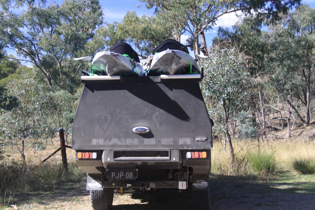
So, we have about four weeks to kill before we go back to Fremantle to complete our repairs. Normally that wouldn’t be a problem, we’d just pick a destination and go. But the issue with the van is that we have two bent axles, and scrubbed tires. This means, of course, that we must limit the driving and stay off any dirt or pot-holed roads.

We drove 260kms north from Perth, then spent the next 4 weeks sharing our time between Tuarts, Wandoo and Smoke Bush reserves. They all have time restrictions, which we adhered to…mostly.
All provided good base camps from which we could explore the areas around Jurien Bay, Cervantes, Lesueur NP and the Nambung NP, home to the Pinnacles Desert.
Cervantes was the closest town to Tuarts. Wandoo and Smoke Bush were closest to Jurian Bay, our preferred town. Jurien also gave us access to drinking water, a dump point, and an overpriced but well stocked IGA. Both are coastal towns with pretty beaches a couple of coffee shops and pubs.


- Tuarts Reserve – It’s all about the Bees.
Tuarts Reserve is a great little bush camp. It’s restricted to 72 hour consecutive stay, and we could see why, it is very popular with travelers.


We’ve been cooking and eating outside lately, and while we were doing the washing up, we noticed a few bees trying to drink from the washing up bowl. Now, bees and hot washing water don’t mix, but they were obviously thirsty, so we got them some fresh. Within a few hours, I think we were watering the whole hive. Have you ever seen a bee tongue close up? Well, you will, and they are fascinating.


A little later Peter found a hive. It was in an old, hollow tree that had fallen and broken open. It was not a healthy hive, so we were pleased we could help them out a little. The second day we were there I measured the amount of water we gave them. From 7:30am to 6:00pm, they drank 1.4 liters of water.


While I had a captive audience (their water was on our table) I made the most of our tiny neighbours’ to practice my “Bee in flight” shots.

On our last day at Tuarts Reserve, I took a wander around the camp, saw an old takeaway container at the base of a tree, bent down to pick it up, and when I looked up, I found myself face to face with this.


Now this is a healthy beehive.
Side note – No Jo’s were stung during the taking of these photos.
The Pinnacles Desert
The Pinnacles Desert is in the Nambung National Park and is a Unique landscape of upright, narrow stone columns or spires. They’re a bit of a mystery but are thought to have formed 30,000 – 50,000 years ago, when the inland sea disappeared, leaving deposits of shells and stuff that formed the spires.
We arrived around 3pm, hoping for some nice sunset shots. We did a lap of the drive, casing the joint for potential spots, stopping along the way to explore.


Picking our sunset spot was a bit tricky, we had to avoid all those pesky tourists 😊 but we found a spot with some unusual formations and waited for the sun to go down.


We had a lot of fun and were lucky enough to be there on a full moon, and what a moon it was.


- Wandoo Reserve – It’s all about the Birds
We drove 34kms to Wandoo Reserve, also a 72 hour stay, but this one was not as popular. We had it to ourselves most days and on occasion, we stretched our visit to five nights. Shhh! Don’t tell the Rangers.


We hadn’t been there long when I grabbed my camera and went in search of the birds I could hear. I was thrilled to see a pair of Rainbow Bee-eaters, such pretty, exotic birds. Over our time there I saw a few species for the first time; Western Corellas, Straw-necked Ibis and…Carnaby’s Black Cockatoos.


Of course, there were other, less exciting but still pretty birds in the area. I identified 16 birds at Wandoo, and there were others that I wasn’t able to ID.


- Smoke Bush Reserve – Its all about the Carnaby’s
A mere 10kms from Wandoo, is Smoke Bush. This is a 24 hour stay, we stayed longer than that, but in all the time there, we never had any other neighbors. The Reserve is just a large gravel pit, but…it is elevated, surrounded by lovely country and it picked up the coastal wind. On a hot day, we just opened op the windows and stayed cool. No heat, no flies, great outlook, and this was the only place we had any kind of phone reception.


It also turned out that we were on the flight path of a flock of Carnaby’s Black Cockatoos. Not every day, but most, they flew by. As they got used to us, they came ever closer.


There was also a magnificent Black-Shouldered Kite and a local Brown Falcon.


Not far from Smoke Bush is Lesueur NP. I have to say, WA is not my favourite state, but…they do have some amazing flora, and at times we could be fooled into thinking we’re in a different country, not just a different state.


So, even though we’ve been in a bit of a holding pattern, we have still had plenty to keep us occupied. Once the car and van are fixed, we can once more hit the road in earnest. Well, at least for three weeks, then we must be back in Perth to meet mum at the airport. (Told you we wouldn’t forget.)
Editors Note
If you made it all the way to the bottom of this post…I thank you.
It is longer than the usual, but I am now officially up to date and we should get back to shorter more manageable posts.
See you out there somewhere
On tow and on the go!
11th October– 27th October
This was the last leg of our trip to Perth. Yup, we finally made it, and checked ourselves into Fremantle Village on 11th October. We had the usual medical and mechanical check-ups, and were keen to have a look around Perth, but we’ll get to that later. First, we had a couple more stops on the way. An overnight stay at Boscabel Hall and a few nights at Boddington.

Not much to say about Boscabel Hall, other than it’s a really good overnight stop. A big open area, nice, and a few birds.


Then we came upon Boddington and what a lovely little town this is. Very pretty, beautifully kept, and with a river flowing through it, plenty of birds. Way over the other side of the river bank I spied a nest and a couple of young Spoonbills; one of my fav waders. ☺️
This is a very popular spot, with a lovely rose garden nearby, so parking spots at the 72 Hour RV camp site, are at a premium, so get in quick.


So, back to Fremantle Village. I don’t think that the Fremantle Village caravan park is actually in Fremantle. You drive past the “Welcome to the City of Cockburn” sign, then put the indicator on to turn into the Village. Cockburn is a light industrial area, and not particularly pretty. Still, it was a short drive (about ten minutes) to South Fremantle and another five to the Fremantle harbour area, the starting point of the Americas Cup yacht race Yet another five minutes gets you to North Fremantle train station which offers $2 per day parking, and an easy train ride into the city of Perth.


We had booked in at Fremantle Village for two weeks, having organized some repair work on the car and maintenance on the caravan. True to form, even though the car repair had been arranged a couple of months earlier, communications between the repairer and the insurance company had ground to a halt so we extended our stay another week to get the work done.
That too, was in vain and now we’re going back on the 21st November to get the work done. 😒 Nothing’s ever easy when you live on the road.
During our three weeks, we did quite a lot of exploring. Including several hours roaming Kings Park, in particular, the Botanical Gardens. We’re at the tail end of the wild flower season, but the park was still stunning and we saw some different flowers.


The caravan maintenance went without a hitch. Tony from Westcoast Trailer & Caravan Service, came to us and did a great job with the van. He fixed the brakes, re-packed the wheel bearings, and gave Chunky Bum a thorough going over. Sadly, he found a few more problems and parts needed to be ordered. Luckily, we will be back on the week beginning the 21st and can do the work while the car is being repaired.
Perth city is… well it’s a city. It certainly didn’t grab us the way Adelaide did, but the area around the river is quite lovely. I was able to catch up with an old friend, and that was wonderful.


The 21st of October marked one year since my operation, and I’m pleased to report that my latest check-up was all good, and both Peter and I are fighting fit, and still loving life on the road.
We spent a fun day in Mandurah, visiting the Giants of Mandurah, if you want to learn about them, follow this link – https://visitmandurah.com/giants-of-mandurah/
We only saw three of the five, as we had a better offer to have lunch with Peter’s cousin. It was great to catch up, and the lunch was delish.


We did a few day trips around the area, and into the city and of course a day trip to Rottnest Island. It’s a thirty minute ferry ride over to the island, then you can explore on foot, bike, bus, or a combination of these. We did the foot and bus combo and had a great day. The bus took us past an Osprey nest that he said had been in use for about 100 years. Each season, the breeding pair will do a bit of maintenance on the nest and raise their young. This year they have two bundles of feathers to feed.


And I’ve saved that best till last. Rottnest island was discovered by a Dutchman, Willem de Vlamingh. He thought the island was overrun with rats, hence the name, Rottnest (Rat’s nest) Island. What old Willem thought were rats, are the cutest little marsupials called Quokkas. I’m pleased to say they still live happily on their island.


See you out there somewhere
On tow and on the go!
22nd to 25th September
This post is going to be short on words, long on photos, and not a bird in sight. My headliners are just a few of Western Australia’s wild flowers.
First off, a little about Lake Grace. It’s southeast of Perth and for the most part, is a system of dry salt lakes, but when in flood, Lake Grace forms two very large inland lakes. The lake is known for its colours, pinks, mauves, and greens, but like all salt lakes, the depth of colour relies on the environment. When we were there, we saw shades of pink, but I have to say, nowhere near as impressive as Lake Bumbunga.


We stayed at Lake Grace for three days and spent most of the time hunting wildflowers. They may not move very fast, but…you really have to hunt them down. Here are some of the roads we took.


Now to the main event. There are a lot of images, but I did cull them…a lot, so there could have been a lot more. ☺️ If you make it through them all, I hope you can find your favourite. I know which one mine is.
To date we haven’t seen fields with massed flowers, wrong place, wrong time, but along the roadside near Lake Grace we got an idea of what the massed flowers would look like.


I must say, I have never seen a flower with such vibrant blue as these, and they have not been photoshopped at all.


One of the magnificent things about some of these flowers, is their uniqueness.


The first flower in this set is my personal favourite, and Peter found it for me. It is so delicate and pretty and perfectly formed, I just love it.


These too, are particularly delicate, and what is hard to tell from the photos, is that some of these individual blossoms are no larger than my little finger nail.


Here are some more unusual flowers. The first is so intricate and delicate, whereas the second could be formed in wax.


Purple is one of my favourite colours, and these flowers celebrate the colour in style.


Red and yellow, a match made by Mother Nature.


The first images in this set were a much bigger blossom, about the size of my clenched fist, spldi almost succulent petals, whereas the next are delicately feathered, they look so fragile.


And last but not least, the humble white flower, not so humble, just lovely.


I hope you made it to through them all, and like me, were blown away by this small selection of WA’s wildflowers.
See you out there somewhere
On tow and on the go!
26th September – 5th October
We headed east from Lake Grace, (I know, we’re supposed to be heading west) through Lake King, another salt lake, and slightly more pink than Lake Grace, then south to Ravensthorpe. They have the wildflower show here every year, and though we knew we had missed the show, we thought there might be some gardens to enjoy. We were wrong. Apparently, the flowers are brought in, and displayed in the herbarium hall. Not what we expected, so we continued on south.


We were looking for a place to stay for the night and saw the sign to Hopetoun. In an instant decision, the indictor went on and we turned right. Hopetoun is a lovely little town right on the beach, and we enjoyed three nights in the 72 hour RV stay just a short walk to the beach.


Fifteen kilometres from Hopetoun is the Fitzgerald NP. We did a day trip there and were so impressed, that we booked into the Hammersley Inlet Campground for a five night stay. It was a bit hairy getting to the campsite. The last leg was down a 25% decline, which really tested the breaks on both the car and the caravan, and of course the climb back up was a tad worrisome. Still, with a bit of a run-up, and me ready to jump out and push, we made it to the top.
It was lovely, peaceful except for our noisy neighbours.


We had only been there a few hours before we realised we would have to cover up the mirrors, and the tow ball and anything else with a reflective surface. We didn’t mind them messing up the car, but they were going to exhaust themselves in their attempt to chase away their own reflections. Very pretty, but not the smartest bird in the nest.

It was only a short drive to the waters edge for Peter to drop the kayak in and go for a paddle. I still can’t bend my ring finger after the fall at Gawler Ranges, (can’t grip the paddle) so I had to walk to the beach, while Peter cruised. 😊


We had previously walked to the beach together, it’s just over 2kms, but it is quite a challenging, undulating walk over Sand, soil, stones and stairs.


The walk was well worth the effort. Peter beached his kayak at the end of the inlet and walked the short distance to the Indian Ocean. We went to the beach a few times, it was way too cold to go swimming, but very pleasant to tip our toes in. The beach stretched for miles in both directions, the south was all sand and sand dunes, while the north was rocky and really interesting to explore.


On one of our trips to the beach, a particularly windy day, Peter caught us a meal of Australian Salmon. I’d been exploring the rocks, and I came back to find Peter frantically digging in the sand. He had been told that the best way to keep fish fresh without ice, was to clean and gut them then bury them head down in the sand. He had buried them with their tails sticking out, problem was the strong wind had covered them up and he had no idea where there were.


He did eventually find them, and they were delish.
The Fitzgerald National Park is a wonderful place to explore, we saw more wildflowers.


A few birds and bees and bugs.


And a very relaxed Whistling Kite


Not to mention some amazing scenery.


After our stay at Hammersley Inlet, we spent a few more nights back at Hopetoun, before moving on.
See you out there somewhere
On tow and on the go!
20th – 22nd September
Wave Rock: I think most Australians would have heard of, if not seen the iconic photos of people “surfing” the wave (I know my mam and dad did). 😊 So, we were excited to visit and “surf” the wave ourselves.


Let me tell you, it’s not as easy as it looks, that slope is deceptively steep, and even though we don’t look as though we’re very high on the wave, we were slipping down even as the photos were taken.
Wave Rock is an impressive rock formation, and the colours of the striations, especially when the sun hits them, is pretty awesome, so we couldn’t understand why they’d build an ugly wall across the top of it.
Our first thought was that it was built to stop people falling off, (those of you who know me well, will know my thoughts on that). But that isn’t the reason.

You can walk up on top of the wave, it’s not a pretty walk, industrial looking stairs, high, wire fences and lots of Keep Out signs. But the reason for this, and the wall, became clear when we reached the top. Off to one side of the wave is a dam and those ugly walls act as a waterflow management system, ensuring that as much rainfall as possible flows into the dam. So, I can live with the practicality of the walls, though they could’ve made them prettier. 😉


The top of the rock was similar to McDermid Rock, though not as impressive. Still, we wandered around up there for a couple of hours, enjoyed the views, and spotted our next destination way off in the distance.


At the base of the Humps is Mulka’s Cave, one of the oldest rock art caves in southern WA and well worth the look.


The Humps is another big rock formation and by far our favourite. Bigger and bolder than McDermid Rock and Wave Rock, with more troughs, and gullies, peaks and oases, we stayed up there until the sun was low in the sky.


There was something prehistoric about this landscape, I mean can’t you just picture a herd of Brontosaurus wandering about in the valley below? We didn’t see any Brontosauruses, but found some boulders to play on. What can I say? We’re easy to please. 😊


The water in the ponds was crystal clear and delicious. As fresh as you can get, at least, that’s what Peter told me.


There wasn’t a lot of wildlife to be seen, but this bird of prey, a Brown Falcon I think, kept me busy for a while.


I stalked this bird for thirty minutes or so, got a few shots then decided to park my bum on a rock for a few minutes. I hadn’t been sitting long when I realised that the hunter became the hunted. I was minding my own business, enjoying the view when my peripheral caught a movement. I turned to my right in time to see the falcon coming at me, in a head on attack… No Kidding! At really high speed he passed over my head so close that I thought I’d lost my cap. I thought Peter would come running to my aid, but the sound of his laughter in the distance told another story. Falcon 1 – Jo 0
In this area we stayed a couple of nights in Hyden at a little spot called ‘The Camp’. It’s a lovely little town and they’ve done up a really good display of the local characters from years past… kind of a rusty history told in rusty sculpture. Really good.


See you out there somewhere
On tow and on the go!