Caravanning Camping Touring
Let me share some of our stories with you. I'll try to keep it fun and interesting, with heaps of photos, hints, tips and reviews all relating to life on the road.
15th – 20th September
Our next stop was McDermid Rock, followed by The Breakaways. We didn’t know what to expect at McDermid Rock, other than a bush camp near a big rock, but we were looking forward to getting away from the wind and the dust and the sand blasting from Lake Ballard. We had to go via Kalgoorlie so decided to make the most of civilization and clean the van.


As you can see from the photos, yet another plan was foiled. 😊

So, on to McDermid Rock.
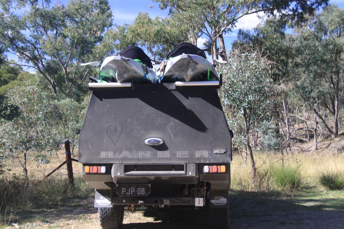
First up, the road we took was a bit dodgy. We thought it was a main road, but more than once, we had to ask ourselves if we hadn’t taken a wrong turn somewhere, as there was nothing but dirt.


Anyway, we arrived safe and sound, having traversed more corrugations, fallen trees and washouts. We set up camp and in short notice, decided we’d have to stay a few nights.


We spent hours exploring McDermid Rock, it was steep in places, but we were able to pick our way along, up, over and around the rock.


We were fascinated by the many water holes and mini oases on the rock. These small patches of flora cling to life on this otherwise barren rock and they remined us of the rockpools you often see on a rocky coastline, little Eco systems all on their own. The water holes and the oases, I am sure, make life a little easier for the birds, lizards and…tadpoles.


There were a few lizards in the area, I identified two distinct sub-species. Pretty Boy (Ornate Lizard) and Stanley, (Crested Dragon – feel free to correct me if I’m wrong). Until I was able to go online to identify them, I had to make up names for them. Pretty Boy and Stanley seemed to fit. I’ve become quite fascinated with our scaly friends, there are so many variations in colour size and behaviour. And like my friend from Lake Ballard, I’ve no idea what he was, these little guys don’t back down.


We are discovering that the tourism marketing team in WA, just as in all the other states, do a great job with their glossy tourism magazines and brochures, to make things look bigger, better and bolder than they actually are. We have followed a couple of the wildflower trails and have seen none of the massed, open fields of wildflowers…yet. However, there is indeed a wide variety of beautiful flora in WA, you just have to go off the beaten track to find it.


A group of Twitchers pulled in next to our camp one morning, and we got to talking to them. They had come here specifically to see a Chestnut Quail-Thrush. Peter picked their brains and got directions to the last known sighting, so next morning at 06:30, we went hunting Chestnut Quail-Thrushes. Peter spotted three or four, I only saw one female, but did manage to get a few shots before it scurried away through the scrub. It may surprise you, but I did a bit of bird hunting throughout our stay. I didn’t get many but there were a couple of new sightings for me.
I was happy with the Super Blue moon shots I took at Kalgoorlie, thanks to some advice from a fellow traveller, 😉 so I decided to try my luck for a few night shots while at McDermid Rock.
I couldn’t get the lighting right on this first shot, but I love the way the old moon is still visible by Earth-light (sunlight reflected off the Earth to the moon and back again).


Reluctantly we left McDermid Rock and made our way to The Breakaways. So very different from the Breakaways at Coober Pedy, but very interesting. The Breakaways might have been better named the Drop-offs as the entire area appeared to be a giant sink hole. Well worth checking out even though we only stayed for one night.


We decided to try some more night shots and this time we got technical, we dragged the telescope out (Celestron NexStar8 SE,) then connected my camera (Canon 5D,) to it. Next we connected the camera to my laptop. We certainly need more practice using this technique, but love the results and I think we might be doing it again.


So, unless we get picked up by some little green men for being too nosey…we’ll check in again soon.
See you out there somewhere
On tow and on the go!
9th – 12th September 2023

I’ll start by saying Lake Ballard must be one of the most visited, remote, tourist sights. We were there for three nights, and there was a constant stream of day trippers and overnight campers, and for good reason. It’s a relatively short drive from Kalgoorlie (207 km) and on sealed roads most of the way.
The drive will take you through the little town of Menzies, once a bustling town of ten thousand, now a home to a meagre 103 residents. There is a lot of history here and of course, they still have a pub and the beer is icy cold. 🙂
Lake Ballard is just another Salt Lake, so why is it so popular? I’d say ethereal sculptures (placed strategically over ten square kms of Lake Ballard) are the draw card. These fifty one sculptures, created by Sir Anthony Gormley, seem alien in nature. Couple that with some striking hills, perched on the otherwise flat salt pan and you have a landscape with a distinctly off-world feel. The lake is mostly an ochre colour but if you get the lighting just right, it turns a delicate shade of pink.


If memory serves, all fifty one sculptures are based on residents of Menzies, plus a couple of ring-ins. Each had a full body 3D scan (naked). The data from these scans was reduced to 1/3 actual size and used to create the steel alloy statuettes. We walked to twenty four of the statuettes, and viewed forty one from the hill top.
The first day we arrived, we had glorious weather, with a sky that screamed…”Shoot me”. So, I did. Along with the statues and the landscape. In a way it’s a shame that the area is so popular. When the statues were installed, the lake was a clean white salt bed, (I saw some photos) but now, with all the foot traffic, the salt has been replaced with dry, ochre/pink dust.


That first day, we also had a lovely sunset to enjoy, all in all, we had a lot of fun and we were up early the next day to enjoy the sunrise. Yes, I know that’s unusual for us but the photos below are proof – we even got the early moon being chased by Jupiter.


The weather wasn’t so kind the following two days. It was hot and windy. Each day, between 10:00 and 10:30, the wind arrived. The atmosphere was full of fine salt and sand particles…so was the caravan. But we still went out and had some fun.


We took the opportunity to fly the drone from the hill top, and we got some decent shots. It’s a shame drones are banned in so many areas, because you don’t often get a chance to see an area from a birds eye view.


There hasn’t been a lot of wildlife around, but there have been a few lizards, and I have to say, the WA lizards have a bit of attitude. These little guys, about twenty centimeters from nose to tail, are not afraid to stand their ground.


After playing with the drone, I thought I’d get my Lens Ball out. You get some good effects with this, and I had a bit of fun with it. Hugo even managed to drag himself out of the caravan, though the wind was causing him a bit of grief, he didn’t want to miss out on meeting the “aliens”. I swear, that bear will believe anything you tell him.


We would have stayed longer, but the fourth day showed no reprieve from the wind. We’d worn our broom down to a nub with all the sweeping, and we were getting tired of eating sand/salt/dust, (it was that bad) so we stowed away our goodies and hit the road again.
See you out there somewhere
On tow and on the go!
Peter’s post

So, on we travelled on this epic drive and although enjoying the drive, we were looking forward to the western end of the Nullarbor. Norseman was looming but it would take us another two days to get there. Overall, we think we did pretty well, taking nine days to cross from Ceduna.


We’ve been so long aiming for WA and listening to all the feedback – the magnificent scenery, the deserted, isolated Nullarbor Highway, the wildflowers – so much to look forward to. But based on our first experiences in WA that is still in the future for us.
It’s not exaggerating to say that from crossing the SA/WA border, three things have stood out. The rubbish, the flies and the temperature. There is much more rubbish than we’ve seen anywhere else. I always do a rubbish pick up, no matter where we stop. Some places may only be a few bits and pieces, others, a bag. But WA has broken the record. In one park I picked up three big bags of rubbish and at the next it was four and in the end I only got half of it tidy. Why are people so unthinking and grubby when they get away from home?


Mind you, I did have some good experiences; lots of happy thumbs-up and trucky horns blasting as they saw me picking up rubbish, and at least two people took up the challenge and helped clean up. One lady really did a great job – so good to see.
Maybe the rubbish contributes to this, but this leads to the flies. We saw more flies in the first few days of WA than we have in a year in SA, it certainly is fly-net territory.
Speaking of summer, our temps in SA were still giving us tops of 17 degrees, or on a good day, a top of 24. Our first day in WA was 33 degrees! It’s been in the high 20’s low 30’s since then, and it’s not even summer yet. This begs the question: Are we in a different state, or on a different planet?
It felt good to drive into Norseman. It’s a nice little town, you get a sense that the locals really try to make it that way. It’s actually bigger than we expected and we got the van tyre repaired here at a reasonable price and with good, friendly service and we got our first glimpse of the famous WA wild flowers.


Mining is such a giant operation in this area. Really for hundreds of kilometres there are mine sites, lots of road trains and I think that at least sixty percent of vehicles on the roads are work utes. But all around the mining sites is a really unusual and interesting landscape. Bushland with great granite boulders strewn around haphazardly and expansive, dry salt lakes. We spent hours exploring in the bush and it was really nice.


KALGOORLIE
With the tyre repaired we headed off for Kalgoorlie and actually managed to do it in one day! And it was a whole 184 km!
Kalgoorlie has a well organised and very well policed 72 Hour RV rest area. It’s only for self-contained RVs and has water to refill the van and a dump point. It’s very popular and about fifty vans and motorhomes use it every night.
The day after arriving (Friday) we went out for lunch at a local hotel. A really nice old hotel with great food. Sitting on the balcony we overlooked the main street and it was a lovely afternoon. When we got back home we were a little surprised to see a ranger waiting for us. We were politely but clearly advised that we couldn’t stay if we were to continue to drop water from the caravan. The problem was a freshwater tank drip (about a drip/second, certainly less than from water heater condensation). I had to put a bucket under the drip! Well, as Jo always says, silver lining. It prompted me to fix the leak!


The 31st of August produced a blue moon, and the biggest full super moon of 2023. Jo likes to take shots of the moon, but it is tricky, seeing as it’s a giant ball of light. This blue moon, not named because of its colour, was the reddest moon we’ve ever seen. The first shot shows the moon low over the mine slag, and the colour has not been enhanced at all. The second shot was taken much later and higher in the sky. These are followed by shots of the mine at Kalgoorlie, which happens to be the longest running Gold mine in Australia, the first gold strike was in 1893, and it’s still going strong.


Kalgoorlie has everything you could ask for including a Bunnings and a Supercheap Auto, so the next day (Saturday) we went shopping to Supercheap Auto. When we got back to the car it wouldn’t start. We called RACQ and they passed the job on to RAC WA and within ten minutes… yes, ten minutes, we were rushing back to the car to find Heath patiently waiting for us in is RAC van. He was really helpful, but after an hour, gave up. So, another call went out to RACQ and half an hour after that, Heath was back, this time with his tow truck. He quickly got the Ranger up onto the tow truck, packed us in the cab with him, and took us 300 metres around the corner to KJJ Mechanical & Engineering.


Trouble was that our van was now stranded in this very well policed 72 Hour MAXIMUM RV rest area. Another call to RACQ and an hour later, Heath was back yet again, this time with his Jeep. He hooked up to Chunky Bum and towed her a couple of kilometres up the road to the Goldminer caravan park, hmmm.

Seems the ‘Goldminer’ had been sold off and was now a work camp. It was somewhat less than an attractive ‘tourist park’ but the wind and dust were flying most of the time and inside was the place to be.
I have to give a shout out to RACQ/RAC and to the record time and great service. Everyone was just so helpful. RACQ, Heath, John, Reece and team at KJJ who also loaned us the workshop ute to get around in – all brilliant! It took all week and over $2,500 to get back on the road with a new fan pully and housing.
Oh, and while exploring Kalgoorlie and surrounds we found a rather unusual tourist attraction – a bush two-up school. I think OH&S might have a thing or two to say about this. 🙂


We picked up the car on Friday and left Kalgoorlie next day for Lake Ballard, that should be a welcome reprieve from the wind and the dust.
See you out there somewhere
On tow and on the go!
The Treeless Plain
Is the Nullarbor a Treeless Plain? In a word…Nope. However, it is a very, very…very long road. Starting at Ceduna in SA and finishing at Norseman in WA. The road across the Nullarbor Plain (the Eyre Hwy) stretches for 1,201 kilometres. Just to put this in context, and for friends and family in the UK, that’s the equivalent of driving from Southampton to John O’Groats, (the southern end of the UK to northernmost part) 1128 kilometers. You can easily drive across in two days, most caravanners take a comfortable three days to drive from Ceduna to Norseman. It took us nine.

No we don’t drive that slow, but if we find somewhere nice to stay…we stay.


There are no towns as such on the Nullarbor, but there are several small roadhouse communities along the way. Penong, Nundroo, Yalata, Nullarbor and Border Village in South Australia. Then in Western Australia you have, Eucla, Mundrabilla, Madura, Cocklebiddy, Caiguna and Balladonia.

You can get fuel at all of these roadhouses, (check your fuel prices before if you can, it isn’t cheap) most have a caravan park attached, a couple have pubs, and of course, your typical roadhouse food. The traffic you see are mostly RV’s and big rigs. We thought ours was big until we pulled up next to this guy. Actually this B-Double is just a little guy against some of the sixty metre long, 200 tonne three and four trailer road trains we saw.


Apart from the roadhouses, there really is no reason for stopping. Unless…unless your name is Peter, and you decide to climb the one hill on the Nullarbor. Granted it was a big, long hill, and it did deserve climbing. Peter’s hill turned out to be part of the Fraser Range, halfway between Balladonia and Norseman.


If you’re going to get a flat tyre, you might as well get one in the middle of the Nullarbor. We did. We pulled over into an overnight camp, not far from Madura. Peter got us set up with the levelers under a wheel, and I went inside to take a couple of beers from the fridge and into the freezer (we like them frosty). By the time the beer was icy, Chunky Bum had developed a definite lean. Hugo went to check the situation.


Our Oricom tyer pressure monitor confirmed our predicament, the bottom left reading shows our flat tyre’s pressure. Knowing how accurate it is was reassuring, had we still been driving, an alarm would have sounded long before the pressure got that low.


So, what did we do? Well, we did what any good, self-sufficient Aussie would do. We dropped the legs on the van, enjoyed our beers and left the job for tomorrow. 😉 This was our first flat since we’ve been travelling, but we handled it well and within a few hours, (the following day) were all done.


We did have one problem that nearly stopped us in our tracks. Our spare is secured with a bicycle security chain. With the many hundreds of kilometers of dirt road we’d travelled, and even though we have a cover on the spare wheel, the locking mechanism was clogged full of dirt.


It took us a while, but with our Ryobi blower, a toothbrush and a paperclip, we managed to clear the keyhole so we were able to unlock the spare. To prevent this from happening again, I put a thick cover of glad wrap, held in place with a hair tie, over the lock. Yes I know, neither of us have hair long enough for hair ties, but they have a million other uses.
We would have fixed it sooner, but we had a novice mechanic helping. And I use that term loosely. He spent more time playing than working, and he paid for it in the end.


With the tyre fixed we got back on the road, and here we are, in the middle of the longest straight road on the planet (according to wiki). We drove for 146.6 kilometers in a completely straight line between Caiguna and Balladonia. No bends nor curves; make sure you have plenty of coffee, or some stimulating conversation, or some loud music or, all of the above. 😊


I think every Australian should drive the Nullarbor; it is a bit of a rite of passage. No, it was not what we expected, no desert, no stretches of vast nothingness, but an experience non the less. We should also hold in mind the fact that the drive across the Nullarbor (the Eyre Hwy) follows the southern-most edge of the Nullarbor Plain which extends hundreds of kilometres to the north and that really is a lot more desert-like.
See you out there somewhere
On tow and on the go!
Our four days in Ceduna were spent running around. The hospital, shopping, washing, car and van washing and the local pub. The food was so good there, we ate at the pub twice. Ceduna seemed quite nice, (they let us buy alcohol so that was a bonus). We stayed at the Shelly Beach caravan Park, about six kilometers out of town, and I think that was the pick of the three parks there.
Our last detour in SA took us to a little fishing village called Fowlers Bay, it offers a great jetty and whale watching charters. A great place to disappear in.


The next few days took some precision planning. I asked Peter if he wanted to be in SA or WA for his birthday, on the 22nd. He said, “Both.” 😉
So, we left Shelly Beach, Ceduna on the 19th and stopped for the night at a roadside camp, about fourteen kilometers west of Penong, famous for its many, (and the biggest) windmills. Sorry, no photos we didn’t stop.
The night of the 20th was spent at Bunda Cliffs, at the beginning of the Great Australian Bight. OMG! Talk about an outlook, this was awesome. Sheer cliffs down to the ocean as far as you could see.


And how lucky were we? Not more than thirty meters from the cliff were some whales. I think they were Southern Right Whales. We’ve seen our share of Humpbacks, but never these before. There were more out there, we could hear them and see them in the distance, but these were so close, it was amazing. If we hadn’t had a schedule we would have stayed there longer.


It wasn’t just the whales that made this stop special, we had an amazing sunset and a sunrise that was well worth braving the cold to experience. We also met a lovely couple (you know who you are) and that always makes a place more memorable.


We camped ten kilometers from the border on the night do the 21st our very last night in SA. We arrived in South Australia on the 10th July 2022, 13 months and 12 days ago, (or 407 days) but who’s counting, so, we had to celebrate our last night. We found a great spot, and some firewood (thanks to whoever left it), and we reminisced over our time here. We also got a little drunk, but that’s another story. 😊
True, there were some things that we could have done without, but…we would not have explored South Australia the way we have had these things not happened, and what a wonderful state it is. We have thoroughly enjoyed it and, truth be told, a little sad to be leaving. But…WE ARE LEAVING!


Now, where was I? That’s right the 21st. We woke up, made a coffee to go, and went. We drove up to the quarantine check point and border at 09:22, and by the time we had cleared the check point and crossed the border, it was 07:52. How cool is that, we’re time travelers!


Yes, I know. For all of you sticklers for accuracy, the time change is actually somewhere between Ceduna and the border, so technically we crossed the border at 07:52, but I couldn’t get my “Time travel” comment in if I’d stuck to the facts, and I’ve been itching to do that.
And here are the first WA roads we travelled. I know! Isn’t it thrilling!


I did mention in passing that we washed the car and van before we left Ceduna, that’s why I picked all the dirt roads. This one was more sand than dirt, but it was taking us to a special spot for Peter’s birthday breakfast.


After breakfast we got back on the road, it was still early, eleven-ish, and as nice as our brekky spot was, we wanted to go further. But not before stopping to enjoy the view from one of the Great Australian Bight Marine Park lookouts. I know I’ve said it before, but my photos really don’t do this scenery justice. The scale is immense and you just can’t capture it in one shot. I hope it gives you the idea though.


Finally, we made it to the wonderous, the mysterious, the amazing Nullarbor. The vast Treeless Plain.
Or is it? I’ll let you know soon.


So, Peter got his birthday wish. We woke up in SA, and travelled into WA where we celebrated his birthday (a few kilometers west of Eucla) with fluffy pancakes, ice cream and maple syrup for breakfast, (we had no fruit because of the border crossing). From there we drove another 50 kilometers to our camp for the next few nights.
I mean what’s the rush – we’re here now.
See you out there somewhere
On tow and on the go!
The Gawler Ranges

After the extended time we’d spent in SA, I thought it was fitting that we spend some time just chilling. The Gawler Ranges NP seemed just the place for that. Great location, kangaroos, emus and birds for me, and lots of hills to climb for Peter.


There are a few walking tracks near our camp area and we did a couple. The Organ Pipes…


…and Little Yandinga Falls. But that wasn’t good enough for Peter. “I want to go to the top of the falls. I think if we just follow that line and…blah, blah, blah.” So, we did.
We clambered up Yandinga Falls, over rocks, around boulders and across rock walls. I was happy enough to have made it to the top but still he kept on walking. We zig-zagged across the hill until the escarpment stopped us then skirted around the rocky hillside until we reached the top of Little Yandinga Falls.
It was much the same going down Little Yandinga as it was going up Yandinga. It was all very rough and steep and made more interesting as we crossed the hill by unavoidable clumps of spinifex. But we were careful and we took our time.
Adventurous or stupid? It’s a line-ball if you ask me, but it was fun.

The track to the base of Little Yandinga Falls 
Rugged and spectacular 

The only tracks up here are lizard tracks 
Near the top of Yandinga 
Across the hills to Little Yandinga Falls 
So where are we? 
Keep on walking, just keep walking… 
That’s our camp way down there 
Time to go down the falls 

Very steep and rocky 

Reaching the bottom of Little Yandinga
There were pockets of water in the otherwise dry waterfalls, and the combination of water and the warm rocks made a wonderful home for lizards. I counted four different types, it made my day.


The next day, while Peter found another hill to climb, (there’s no shortage in the Ranges) I went stalking wildlife.
The first bird I saw I initially thought was another Rock Parrot, but when I examined the photos, it turns out that it is an Elegant Parrot. There are a few subtle differences but the most obvious difference (in layman’s terms) is that, under the blue “headband” the Rock Parrot has a slightly lighter shade of blue, whereas the Elegant Parrot has yellow.


There were also wrens and Australian Ringnecks, and a few other birds around our camp area.


I’m no bird expert, so if I ID any wrong, please let me know. 🙂
We went for a drive to the Old Pondanna Homestead, and there were heaps of emus in the area.


While I was off stalking them, Peter prepared the picnic lunch he had packed for us. There’s a couple of Mandarins, some biscuits, chocolate and a half eaten cold sausage; A very nutritious meal, no? At least he brought stuff to make tea and coffee but…can you see a flask anywhere? Me neither. 😉


On the way home we saw a lot of kangaroos too. Once more I am amazed at the Variety of colours and sizes. But now, I have my favourite. This guy, Chunky Roo. I don’t think that’s his Latin name, but it suits him.


I decided to go with Peter on his next hill climb and we almost made it to the top, but the light was fading, and we’d come up against dense scrub and a rocky escarpment. The view was still pretty amazing though.


The Gawler Ranges is a pretty cool place to visit, we only had five nights there, but if we had not had a plan (yes, I know that’s a four letter word) we would have stayed longer.


On our last day in the Gawler Ranges, we hoped to spot a Yellow Footed Wallaby, our favourite wallaby. We’d bumped into a park Ranger the day before, and he suggested the Organ Pipes at sunrise. So, that’s what we did. We saw this little lady in the Flinders Ranges, isn’t she gorgeous?


We’d done the Organ Pipes walk already so knew what to expect, an easy walk, with some boulders to navigate near the Organ Pipes. It was here, not waterfall climbing, or vertical bush bashing, that I fell and damaged my finger. Go figure? Peter was giving me space to do my hunting thing but luckily we had taken the two-ways with us so I was able to call him and he came to help.
Seriously though, if you fellow travelers don’t have two-way radios, you should get them. They’ve gotten us out of trouble more than once. And take them with you! They will do you no good sitting at home. I can’t speak for other brands, but the Oricom handsets are tough, (they’ve been dropped a few times) and have a great range. Oh, and we didn’t see the Wallaby.


Later that day we drove to Streaky Bay and visited the local hospital. I needed an Xray and ultrasound, but they didn’t have the facilities for the latter, so they referred me to Ceduna hospital for both. After the scans, Streaky Bay followed up wanting to see me again. When I said I was still in Ceduna, they organised a physio appointment in Ceduna for me. The physio told me that I had dislocated my finger, and partially tore the tendons. She then told me what I needed to do to care for it, as well as giving me a general referral, including imaging, for follow up visits in Perth.
Now this all sounds like a messy runaround, but considering our nomadic lifestyle, and the fact that the doctor, radiologist, and physio were all fly in for a few days, then back to Adelaide or Port Lincoln, the healthcare given was excellent.
I take my hat off to these people who are working with limited resources, and often with people who show no gratitude or who are downright rude. I guess what I’m getting at is, if you’re ever unfortunate enough to need healthcare in a rural hospital, just show the staff a little kindness, because they are doing it tough.
See you out there somewhere
On tow and on the go!